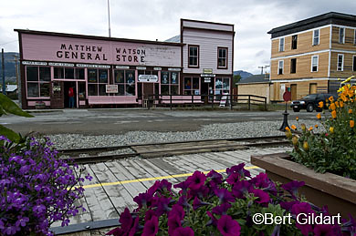
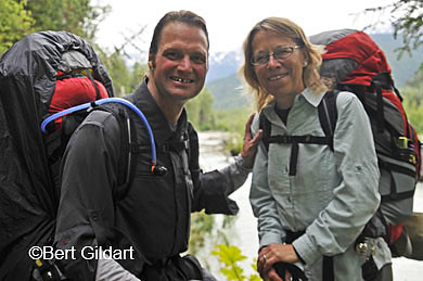
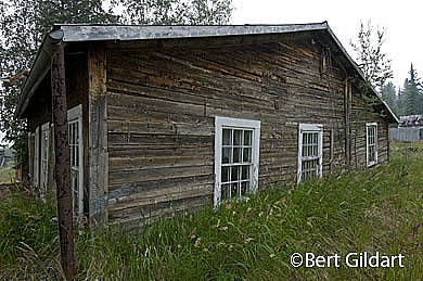
Favorite Travel Quotes

"Travel is fatal to prejudice, bigotry, and narrow-mindedness, and many of our people need it sorely on these accounts."
-- Mark Twain
Innocents Abroad

"Stop worrying about the potholes in the road and celebrate the journey." -- Fitzhugh Mullan

"A good traveler has no fixed plans and is not intent on arriving." -- Lao Tzu

Archive for August, 2009

Is the Section From Liard Hot Springs to Stone MountainThe Most Beautiful Segment of the Alaska Highway? Some Say It Is

posted: August 30th, 2009 | by:Bert

©Bert Gildart: Though we’ve found the entire length of the Alcan Highway to be fascinating, certain segments have their proponents. Several travelers have said they particularly enjoy the segment from Liard Hot Springs, south (or north, if you’re traveling that way) to Stone Mountain Provincial Park, a distance of about 200 miles.

915079150091508


To See Larger Version Click On Each Image. L To R: Steam Rises In The Cool Morning Air From Liard Hot Spring; Fall Was In The Air And The Geese Were Flying Overhead And The Bunch Berry Dogwood Was Already Producing Its Ripe Red Berries; Departing From Liard Along The Boardwalk.

Two-hundred miles is about all we drive in the course of a single day, as photography is such an important component of each day, and that takes time. But when we reached the end of the day, Janie and I both believed we’d seen an incredible number of interesting features, and with that in mind, I’m going to here provide a photo summary with extended captions. Read along, for during our travels of several days ago  we saw where the Rockies end in the north, herds of woodland caribou, stone sheep, and an incredible number of beautiful lakes. These photographs were all made during the course of that  drive and are essentially shown as taken at the time, meaning there are few if any PhotoShop modifications.

ABOUT MIDWAY along in our drive yesterday, we came to a section of the road that had been under construction on our way up. But now, on our way down, the 30 miles dust section had been paved. We’ve also been discovering that the frost heaving of spring had relaxed and so all the road buckling of several months had leveled out.


91502915039150491501


To See Larger Version Click On Each Image. L to R: Close up of Fireweed gone to seed, another sign that fall is fast descending; woodland caribou slow traffic, and in Stone Mountain Provincial Park-part of the Alcan-all drivers seem alert to wildlife; young bull caribou; Muncho Lake and Terminal Range of Rockies meeting Sentinel Range of British Columbia.


That made the drive around Muncho Lake a delight, and we stopped to photograph the point where the Sentinel Range ends and the Rockies begin. All this takes place at Muncho Lake, meaning “Big Lake” in Tagish, the aboriginal language of the area. Wildlife also was abundant beginning here, particularly as we approached Stone Mountain Provincial Park.

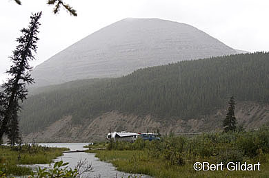
AS WELL AS ABUNDANT WILDLIFE in Stone Mountain, the mountains and lakes were beautiful, and toward the summit of one of the passes in Stone Mountain, we came to a small lake appropriately called Summit Lake.
91505

As one of the highest places along the Alaska Highway, Summit Lake was an appropriate place to park our Airstream.


Liking the solitude, we decided we’d make camp, doing so along a small creek. Before the evening was over, we saw beaver. Several trails ascend and I climbed one, stopping to gaze back over our Airstream and all that surrounded it. Though I would be hard pressed to isolate this area and proclaim it the most beautiful section of the Alcan, I’d certainly concur that it is an incredible section.


_____________________________________________________


THIS TIME THREE YEARS AGO:

*The Citadel, Preserving Quebec’s Peace

ADS FROM GOOGLE AND AMAZON AUGMENT OUR TRAVELS:


Read Comments | Comments Off

Along the Alcan, It’s the Season of the Bison

posted: August 27th, 2009 | by:Bert

©Bert Gildart: If you want to see bison engaged in the all the ritualistic traits associated with the power of the species, mark on your calendar the middle of August. Here, at this time, along the Alaskan Highway, it’s the season of the bison.

91460

Rolling in dirt rids bison of bugs, but also telegraphs a high degree of anxiety.

Yesterday, Janie and I were driving about 20 miles north of Liard Hot Springs, in British Columbia, when we came across a herd of bison roaring like lions, kicking dust in the air, rolling in dirt, sniffing one another… pawing the earth, and butting horns. None of this was done in play; rather it was conducted in earnest and is associated with the hormonal rush these huge beasts are now experiencing. These activities are timeless ones, and are important as they will determine the evolution of the species. Their activities will determine which bulls mate with the females, and when all the formality is over, only the strongest will pass on their genes.

Bison have always inhabited the mountains and forest of the far north; in fact the Canadians have established a vast preserve known as Wood Buffalo National Park, located well east of here. But bison have also inhabited the forest of British Columbia, and if you are lucky enough to see them, you are in for a real treat.

TWO MALES GOING WILD

We saw these magnificent creatures as we ascended from a swale along the road. From the crest, we could see a small herd of bison and even from a distance of half a mile, we could see two males were going wild. Driving closer we watched as they pushed and shoved, churning up forest grasslands over a distanced that covered several acres. Driving yet closer, we could see muscles strain, horns probe.


914689146191469


CLICK ON EACH IMAGE TO SEE LARGE VERSION: L to R: Other cars pull off leaving this Airstream out in the open; bellowing bull means “Watch out;” but that’s something this Neanderthal must not have realized, though he was lucky  — fortune not everyone is accorded.

The action went on for about 10 minutes, and when it ended, neither bull seemed satisfied, meaning the war had not yet been concluded, though a battle had been fought. We settled in to wait, pulling our Airstream off the road, but well away from the herd. I then mounted on a tripod an 840mm lens attached to my Nikon D300 and hoped the action would resume. In the meantime, the few other drivers along the Alcan had also noted the action and they, too, were pulling over. What people do as they watch wildlife, always awes — and sometimes frightens me.

ABSOLUTELY NO COMMON SENSE

Last year, Janie and I were in Jasper when bull elk were battling, and we watched as people violated every common sense rule known to mankind. That day a bull elk charged a motorhome that had entered his space, and badly gouged it. Now, it appeared as though the same thing might happen again, but this time rather than a 1,200 pound elk hitting a vehicle, it appeared as though a 2,000 mass of fury might attack, for the perpetrators were assembling.

A young man stepped out of his vehicle and watched as a bison ambled by, passing within feet of his rented motorhome. Moments later a couple driving a sports car stopped in the middle of the road, leaped out, ran toward the bison, and began clicking with their tiny instamatic cameras. They ran back and speed off, leaving a couple in an Airstream travel trailer (not us) out in the open. The couple had just pulled in, and wisely they sat in their tow vehicle as a bull sauntered in front of them and then crossed the road.

MAN TOSSED INTO TREE

Luckily, nothing happened to any of the wildlife watches here along the Alcan, but I will always recall the anecdote of a Yellowstone National Park visitor approaching a bull bison during the mating season and being rewarded for his Neanderthal curiosity by being charged and then tossed into a tree. This troglodyte got by with just a couple of broken ribs.


914679147191470


CLICK TO SEE IMAGE AS LARGER VERSION. L To R: Bison now battling along Alcan near Muncho Lake; Rolling in dirt rids bison of bugs and adds to drama of mating season; fighting was persistent.


Meanwhile, action in the herd was picking back up, and from a distance I photographed a cow rolling in the dirt, then a bull rolling in the dirt. But not too far away, one of the two bull combatants began roaring again, and minutes later, the two gladiators were at it again.

My 840mm telephoto enables me to capture the action from a safe distance and for over an hour, I worked hard, trying to record this incredible moment. The two bison pounded each other, and I recorded it, but nothing, it appeared would be resolved today – so the war was not yet over. More battles would be fought.

Finally, with about 200 images of a herd of bison, I realized I could do little more. Still, the bison and the din of noise they were creating from all these ritualistic activities, continued. Janie and I remained awed, and for awhile we simply watched. The moment was a timeless one, and we felt privileged on this August day to be part of this rare drama, this season of the bison.

_______________________________________________


THIS TIME THREE YEARS AGO:

*Quebec City


ADS FROM GOOGLE AND AMAZON AUGMENT OUR TRAVELS:


Read Comments | 1 Comment »

Hop Aboard A Narrow Gage Railroad to Relive Stampeder’s Rush to the Klondike

posted: August 25th, 2009 | by:Bert

©Bert Gildart: Just as the outbreak of World War II ended the Great Depression of the 1930s, so the Klondike Gold Rush ended the depression of the late 1890s.

In 1896 George Washington Carmack, Skookum Jim and Tagish Charlie discovered gold on Rabbit Creek, a tributary of the Klondike, located not far from where the Yukon and Klondike rivers converge near Dawson, Yukon Territory. Word went out, and the rush was on. The problem, however, was getting to the Klondike, and that’s when enterprising businessmen began creating routes.

91432

Eventually a narrow gage railroad became the preferred route to the Klondike.

Of the half dozen or so different routes to emerge, the two most popular were the Chilkoot and the White Pass, both located near Skagway, Alaska.

DEVELOPMENT OF ROUTES

The Chilkoot developed from a town known as Dyea, located about six miles from Skagway, and for awhile it was considered the preferred route. White Pass was accessed from Skagway, and though it was 600 feet lower, it was 10 miles longer. For that reason, the Chilkoot was the preferred route, and beginning in 1898 and for several years thereafter, over 30,000 gold seekers toiled up this route’s “Golden Stairs,” a hellish quarter-mile climb gaining almost 1,000 vertical feet.

But there was yet another route, and today, you can sit back in comfort aboard the White Pass and Yukon Route Railroad, and experience much of what yet another group of gold seekers experienced. Rails reached White Pass Summit in February of 1899, and from then on, the Chilkoot’s days as the route to the Klondike were numbered. The four-hour round trip excursion courses through history and through some of the Yukon’s most spectacular country.

TRAIN TO WHITE PASS

Janie and I boarded the train about 8 in the morning, and several powerful diesel engines began pulling about 20 cars along the narrow gage tracks. Soon we passed our campground, and could see our Airstream. The rails continued, soon passing the train yard where the historic steam engine Number 73 sat waiting until the weekend during which time it runs faithfully.

Moments later, we passed the Gold Rush Cemetery and a narrator explained over the loud speaker that by 1898 Skagway had become a lawless town. In fact, the town became so lawless that Skagway began to lose traffic to Dyea, the nearby town competing for business. The outlaw faction was led by “Soapy” Smith and for several years, he controlled Skagway. In 1898, Frank Reid, a surveyor, killed Smith in a shootout. Unfortunately, Reid was also shot and he died 10 days from a painful wound in the groin.

91437914389143691433


Click on each image to see a larger version. L to R: White Pass shack, where the RCMP once waited; trail passes many falls and river, such as the Skagway River; another train along the route to White Pass; our train returns, amidst some sunshine.

As a photographer, the best place to position myself while on the train was on the front and rear platforms. Here, I could photograph the sweep of the trail as it rounded corners, and crossed bridges. From one place, we could look back and see the ocean and we could see Skagway. As well, we could see several huge cruise ships anchored in the harbor. In fact, most aboard the train were from the several ships.

FOG ADDS DRAMA

Typically, the mountain region was foggy, but I thought images of the engine entering the fog added drama, and it helped to better convey the message that this land crossed by the miners was wet and damp. Undoubtedly, the wetness contributed to the variety of illnesses so many miners contracted. Interestingly, scurvy was a leading cause of disease, resulting in general lassitude, loose teeth and bruise-like marks on their bodies. Indians knew a remedy and so did some of the old timers, and that was simply to drink an occasional cup of spruce-needle.

About 10 in the morning, the train neared White Horse Gulch, where over 3,000 horses died, most from abuse. Here, the narrator pointed out that we could also see the old trail, once used by Stampeders.

RCMP MONITORED ACTION OF STAMPEDERS

A few minutes later, the trail entered a second tunnel and then, approached the Summit, which is also the point where the RCMP (Royal Canadian Mounted Police) were stationed to check each of the gold seekers loads. Men were required to have one ton of gear, and much of that was food. The Canadian government knew about the mass starvation experience between 1897 and 1898, “Starvation Winter,” and were determined to prevent a reoccurrence. The RCMP was also posted on the Chilkoot, explaining why it often required months of leap-frog backing to make it to the head of the Yukon, for packs and progress were monitored.

91434

For additional funds, the train will also take you to the historic town of Carmack.

From the headwaters of the Yukon, as mentioned in previous posts, Stampeders would build boats, and then travel about 500 miles down river to the site of the gold discover at Dawson, Yukon Territory.

All too soon, we reached the 2,888 foot high White Pass. Here, passengers are asked to flip their seats so that they are then facing in the direction the train proceeds on its return. Though the return duplicates the country we’d just seen, on the return I knew some of the features I’d missed on the way up and was prepared. I photographed clouds lifting over the hills and the many tributaries of the Skagway River.

We count the trip as one of the most historic and informative in Skagway and highly recommend it.

_____________________________________________________


THIS TIME THREE YEARS AGO:

*The Citadel, Preserving Quebec’s Peace

ADS FROM GOOGLE AND AMAZON AUGMENT OUR TRAVELS:


Read Comments | Comments Off

The Salmon Have Returned

posted: August 22nd, 2009 | by:Bert

©Bert Gildart: Two of Alaska’s five species of salmon have once again returned to the state’s various streams and rivers, following an immense migration from the ocean. The return is a much heralded event, and is the source of art, scientific management and considerable awe. It’s an exciting time to be stalking Alaskan waters!

91403

The return of the salmon prompts various forms of art.

The species we’ve seen vary from location to location, and in Whitehorse on the Yukon, it was the King Salmon, also known as Chinook. In Skagway, along the Skagway River it is the Coho. Other times of the summer see the chum, sockeye and pinks. In all cases, the streams they seek are the streams from which they first emerged as young fry. Now they are returning, using their olfactory senses to seek out the tiny streams that imprinted on their minds.

“It’s like a finger print,” said one of the interpreters at the Whitehorse Fishway Interpretation Centre. “Each stream has specific odors, created perhaps by its chemical or mineral makeup.”

FISH LADDER

Just a few weeks ago Janie, Adam, Susan and I were lured to the Yukon as it passes through Whitehorse. The river provides Kings with the world’s longest fish migration route, allowing these salmon to enter the Yukon and then migrate over 2,000 miles to small tributary streams near Teslin, located in the Yukon Territory. Once Kings had free access along their entire route, but as Whitehorse grew, hydro electric power was deemed a necessity, and so the town built a small dam. Obviously, the dam interfered with the migration, so in 1959, just after completion of the dam, the government constructed a fish ladder, one of the longest wooden fish ladders in the world. In part, that’s what attracted our small group to the interpretive center.

PHOTO TECHNIQUES

The interpretive center is comprehensive offering among its displays a series of aquariums. One window shows young “fry” and I found I could photograph them by placing the lens of my camera flush with the glass. Others were attempting to photograph the fry (young fish) by holding the camera away from the glass, but that way you get glare.  However, unless your lens has a macro mode you’re out of luck as you can’t get close enough to focus. Still, because the depth of field is so shallow — and the fry are moving so fast — you’ll need many attempts just to obtain a few good shots.

SALMON GENERATE ART

Other parts of the center offer displays of Native arts, showing miniatures of fish traps and of the ingeniously designed fish wheel.

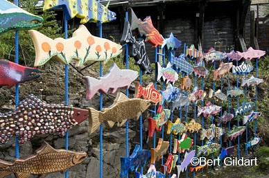
Also on display were artistically rendered fish, created every year by any who wish to participate. Many artists add to the fish wall, and this year, a lady operating our campground created one with an African motif. Most are decorated with germane paintings, or with beads and tacks that create a pleasing pattern. All the fish are then grouped into a display, and the end result is striking.

Adjacent to the swarm of art fish is the fish ladder, and every now and then you can see well how it works. Below you, in the Yukon, huge King Salmon battle in the river’s murky (almost impossible to photograph) waters, just below the dam. Because they can not overcome the powerful waters created by the spill, they are pushed to the sides, where their energy is renewed. With thrusts of tail and bodies, they then power their way up the trough for what appears to be about a hundred yards.


914199140591404


To see larger version click on each image. L to R: Coho salmon now in tiny streams surrounding Skagway; return of salmon prompts artistic intrepretaions, in this case native fish traps and fish wheels; fish ladder help King Salmon around dam.

In this way they make their way around the dam and back into the wild Yukon. From here, they continue their migration, eventually returning to the tiny streams from which they hatched. Then the cycle begins anew, and the following spring, young fry make their way down the Yukon — or the Skagway River — where they enter the ocean.

UP CLOSE AND PERSONAL

For up close and personal observations, Skagway is the place to go, and here we saw Coho salmon. Though not as colorful as Kings (in fact the color of Coho is drab), still the migration is spectacular and because you are so close, you find yourself cheering them on.  This is the final leg of their journey, and you can watch them separated from a vantage point of just a few dozen feet. Get any closer and they spook.

For Kings and Coho, all this takes place in July and throughout much of August. As nature would have it, some were already turning belly up, their job of creating their redds complete.

91400

As "fry" young king salmon will soon start their jouney back down the Yukon, where they'll enter the ocean.

Redds are the nests in which females lay their eggs, which number over 5,000. Males quickly move in and cover the eggs with milt. Shortly thereafter, life for them is over, their role of renewing their kind complete.

THE CYCLE REPEATS

Young hatch in late fall or early winter and are called alevins. They live off the yoke sack and when it is gone they are called fry. Fry begin making their way toward the ocean, though live for about two years in fresh water. At the end of their downstream migration they enter the ocean where they remain for about three years, at which time, they begin their way toward such rivers as the Yukon. Not all kings, of course, originated in the Yukon, but many did – and those are the ones you can see in Whitehorse. Likewise, not all Coho originated in the Skagway River, but these two rivers provide extraordinary opportunities to watch as a cycle three to five years in the making draws to a close – but then makes ready to begin again.

The sight can be both humbling and uplifting, and is one that can be seen in but few places. The Yukon and Skagway rivers offer that extraordinary opportunity.

_____________________________________________________________

THIS TIME THREE YEARS AGO:

*Old Quebec City

ADS FROM GOOGLE AND AMAZON AUGMENT OUR TRAVELS


Read Comments | Comments Off

Once Skagway’s Red Onion Saloon Was a Bordello — As The Popular Tour Recalls

posted: August 20th, 2009 | by:Bert

91439

Steamy and sultry, these girls are exceptional actresses.

©Bert Gildart: The history of Skagway’s Red Onion Saloon is typical of other bordellos that proliferated in the late 1800s, both in Alaska and in the Yukon. Today, though the Red Onion offers a dining facility, it also offers an extraordinarily popular brothel tour. But as the ladies said, “You’ve got to be broad minded.”

Several of the settings reminding me of the Robert Service Ballad, “The Shooting of Dan McGrew,” and so I start this posting with the first stanza of that ballad, essentially because the photographs from my day’s take seem to complement it so well. Some of you may know it. When I was in high school, we got extra points for memorizing the poem:

A Bunch of the boys were whooping it up in the

Malamute Saloon;

The kid that handles the music-box was hitting a jag-time tune;

Back of the bar, in a solo game, sat Dangerous

Dan McGrew,

And watching his luck was his light-o’love, the

lady that’s known as Lou…

Call this lady Klondike Kate, but with that look in her eye, doesn’t she seem to fit the part of Lou?  I thought so.

$5 FOR 15 MINUTES

Once the Red Onion Saloon was a working brothel and tours today recount the history as it was during the late 1890s. The tour is a bargain and costs harken back to the gold rush.  “Five dollars for 15 minutes,” says the Madam, “Just like in the old days.”

Conditions of the time at the brothel are also reported on the back of its menu, and I’ve taken their write-up and included it here. What it lacks is the color of our tour, which was full of innuendo. When I find time, I’ll try and write more about the tour. In the meantime, here’s a mighty fascinating history, illustrated with photographs which I made yesterday. I think these are exceptional images and certainly want to take some credit, but these attractive ladies deserve most as they could be models with their much practiced and professional demeanors. They were humorous and great actresses – to a point.

91444

"A bunch of the boys were whooping it up..." Doesn't this scene fit the classic Robert Service ballad?

The tour for Janie and me was set up by none other than “Buckwheat” Donahue, Skagway’s Executive Director of Tourism and the subject of my last posting. Hastily I want to reiterate that Janie was with me the entire time and helped me with my multiple strobe set up, the only way to create flattering light in harsh situations. And now, from the back of the Red Onion Menu:

BACK OF THE MENU

The Red Onion Saloon, now a National Historic Building, was Skagway’s most exclusive bordello. Built in 1897 with planks cut by Capt. William Moore, the founder of Skagway, the Red Onion Saloon opened for business in 1898, serving alcohol on the first floor while the upper floor satisfied more than the prospector’s thirst. The brothel consisted of ten tiny cubicles, called cribs, each ten foot by ten foot with three exists, one into the hallway and one into each of the adjoining rooms. Each room also had a hole in the floor which connected to the cash register in the bar by means of a copper tube.

91443

Klondike Kate or Pea Hull Annie? Maybe in another life, but today this Red Onion lady provides a most entertaining brothel tour.

In order to keep track of which girls were busy, the bar tender kept ten dolls on the back bar, one for each of the girls in each of the rooms. When a girl was with a customer, her doll was laid on its back. When she sent her money down the tube, the doll was returned to the upright position signaling to the waiting prospectors that she was ready for business. The bartender safeguarded the girl’s earnings, usually $5.00, preferably in gold, while in the crawl space between the floors, loose floorboards had nuggets and private tips.

NOT MUCH SOUND PROOFING

Because the rooms were divided by single planks toe-nailed into the ceiling and floor, not much sound-proofing was provided. To decorate their cribs, the women stretched linen across the rough planks, and then glued wall paper to the cloth. Remnants of the original wall paper still cling to the planks. Some of the girls who worked in Skagway were Birdie Ash, Big Dessie, Popcorn Lil, the Oregon Mare, Babe Davenport, Pea Hull Annie, Kitty Faith, the Belle of Skagway and Klondike Kate.

By the late1899, business began to suffer. Most of the women moved north to Dawson which was closer to the gold fields and had big gambling casinos and dance halls. As the railroad became the center of business for Skagway, numerous buildings were moved closer to the depot.

The Red Onion was moved in 1914 with one horse from Sixth and State Street to its current Broadway location. Unfortunately, the Onion was dragged around the corner backwards and the front and back of the building had to be removed in order to switch them. During World War II the building was used as an army barracks and in subsequent years housed a laundry, bakery, union hall, television station and gift shop. In 1980, Jan Wrentmore purchased a liquor license and opened the building once more as a saloon.

SO THAT’S THE HISTORY as it appears on the back of the Red Onion’s menu, which also provides a portion of the tour’s content. Actually the tour is longer than 15 minutes, and it is probably the town’s most popular tour. Seems like there are thousands off the cruise ships that either want to be “Johns” or “Klondike Kates”. That at any rate is my quickie for the day and will close by saying that both Janie and I highly recommend this “sporting event” for the shear fun derived from a most satisfying presentation, and for an insight into some of America’s very rough and very bawdy times.

It’s the way things were, and it can not be refuted.

__________________


THIS TIME THREE YEARS AGO

*Ticonderoga — America’s First Revolutionary War Victory


ADS FROM GOOGLE AND AMAZON AUGMENT OUR TRAVELS


Read Comments | 2 Comments »

It Was Buckwheat’s Fault

posted: August 19th, 2009 | by:Bert

91426

"It's all Buckwheat's fault," proclaims Adam.

©Bert Gildart: The girls at the old brothel (now known as the Red Onion Saloon) had retired for the evening, while passengers from the cruise ship had been chased off the streets by 40-mile per hour winds prompting most of the town’s other establishments to close their doors.

But the crowning blow was that Buckwheat Donahue did not appear for his scheduled performance. Of course with everyone secure in their homes and back on the boats, there was really no reason for the internationally known narrator to show. However, we’d been looking forward to hearing Buckwheat provide his recitations of Robert Service poetry, and his absence prompted instant despondency.

On docket for the night was to have been the “Cremation of Sam McGee” and the somewhat risqué ballad known as “Bessie’s Boil.” And if the man measured up to the recitations he’s provided on his many CDs and in his live performances before thousands on cruise ships, we knew it would be highly entertaining. But no folks, no show — and that increased our depression.

What do to; what to do? What could we possible find to do on a rainy Sunday night in Skagway, Alaska, when the wind was howling, rain was falling, clouds were scudding over the bay — and when there was no Buckwheat?

ADAM REVEALS GREAT IMAGINATION

We cast around, eyes settling on the one store in town that was certainly open. No Blue Laws here, and no policemen on the streets. Suddenly, with clarion vision Adam knew exactly what to do.  Infused with a sudden surge of energy, my hero of several days ago (Adam, Sue and Stimee) proved himself in yet another manner. He was imaginative, and he quickly trotted over to the liquor store and just as quickly returned with a brown bag from which he pulled a pint of Yukon Jack.

“It’s all Buckwheat’s fault,” he sighed, motioning us with his hand into an alley where he uncapped the bottle and passed it around. Instantly, we knew we had found some powerful medicine — and that a cure for our despondency was possible.

HISTORY UNFOLDS

For awhile, we wandered the streets, watching the Red Onion sign dance and reel in the wind. And every now and then we’d duck into another alley, secreting our intentions and our actions, necessary we felt, for although it appeared that no one else was out and about, who knew what secret eyes lurked from within some of the town’s historic old wooden buildings.

And so we braved the wind, studied buildings the National Park Service had preserved as part of its Klondike Gold Rush Historic Park. We walked by the railroad station where we’d watched earlier in the day as an old steam locomotive returned from White Pass.  Over the wind we rehashed Skagways’ railroad history, comparing notes on how the White Pass and its train service (developed about 1900) put the Chilkoot out of business.


91427_DSC628691421


CLICK ON EACH PHOTO TO SEE LARGER VERSION. L to R: Wind batters sign over Red Onion Saloon; steam locomotive to White Pass returns passengers from cruise boats; cruise boats bring tourists who often attend readers provided by Buckwheat Donahue.

After the train with its services to Carcross, Yukon Territory, Stampeders no longer needed to brave the Chilkoot to access the Yukon River, something well over 40,000 men, women and even a few children had done between the years 1897 and 1899.

BUCKWHEAT’S CDs

Our rehash of history was challenged by the harsh wind, and so (quick duck into another alley to fortify against elements) we walked back to the campground where our Airstream was parked. We loaded one of Buckwheat’s CDs into our Stereo, and tried to immolate the Scottish accent Buckwheat had mastered for this particular ballad.

91410

Buckwheat blends music and voices on his many CDs to create moving Robert Service narrations. "Buy one of my CDs, and you've bought me a beer."

The Yukon Jack helped a bit and I firmly believe as the night progressed that Adam gave a powerful reading, for he was fully immersed now into the spirit of the times. Before long, he was reading from “Bessie’s Boil.”

Says I to my Missis: “Ba goom, lass! you’ve something, I see, on your mind.”
Says she: “You are right, Sam, I’ve something. It ‘appens it’s on me be’ind.
A Boil as ‘ud make Job be jealous. It ‘urts me no end when I sit.”
Says I: “Go to ‘ospittel, Missis. The might ‘ave to coot it a bit”
Says she: “I just ‘ate to be showin’ the part of me person it’s at.”
Says I: “Don’t be fussy; them doctors sees sight far more ‘orrid that that.”

The poem continues and provides a satisfactory resolution to Bessie’s problem. We then changed CDs, inserting one from Credence Clearwater and their lively tune “Proud Mary,” a song all aging hippies will recall. And so our evening floated on, and though I’m hesitant (almost ashamed!) to admit it, the Yukon Jack soon disappeared.

POWERFUL INFLUENCES WERE AT WORK

Some, I’m sure, will find fault in our evening’s activities, but just remember, powerful influences were at work – and we needed a powerful cure, which Buckwheat’s absence forced us to find…

91428

Robert Service readings and music prompted dancing which lasted late into the night.

And now it is the day after Buckwheat’s no show and to prevent another occurrence, we sought out Buckwheat who has assured us he’ll be present this evening. He also said that he did show and that the park service posted the wrong time. He then asked me to participate in his upcoming recitation by playing the part of Sam McGee. Overcome with guilt from my false premise, I agreed, concluding, however, that before we get out of Skagway, this man really could be the cause of our downfall.

Adam, what can we do? What can we do? Come back and put your imagination to work.

—————————————–


THIS TIME TWO YEARS AGO

*Climbing Mount Rainier

ADS FROM GOOGLE AND AMAZON AUGMENT OUR TRAVELS


Read Comments | Comments Off

The Chilkoot Pass – Where Friends Reveal Themselves

posted: August 16th, 2009 | by:Bert

©Bert Gildart:  When the chips are down, really down  — that’s when you learn about your friends.

Two days ago, Adam and Sue Maffei and I were seven miles along on our trip to the top of the Chilkoot Pass, when my back went out. Years ago, when I began having lower back problems, doctors provided me with a series of exercises to prevent such occurrences.

91411

Adam and Susan, helping by toting a large portion of my gear.

When I practiced them faithfully, I’d have no problems, but these past few months we’ve been driving, driving, driving, covering assignments for various magazines, and I’ve not complied with doctor’s orders. I believe the combination set me up for the problems I experienced.

LIFE STYLE — NOT A LARK

I also want to say that climbing the Chilkoot was not some lark, rather part of an active lifestyle in which I’ve always engaged. When younger, I worked  in Glacier National Park as a backcountry ranger, and just two years ago, I climbed Mount Rainier.

Sandwiched in between have been literally hundreds of active adventures, most with Janie. Once, she and I hiked for one month across the entire length of the Arctic National Wildlife Refuge. The outdoors is our life, so circumstances had to be extreme before I’d consider turning back.


91415914169141391414


CLICK ON EACH IMAGE TO SEE IT LARGER. L to R: Cabin at Canyon City built in the ’60s now being restored; one of 100-plus graves resulting from 1898 avalanche; Adam and Sue along Chilkoot trail; Adam hamming it up at one of many Chilkoot artifacts, in this case a huge boiler.


At any rate, I slipped on a rock and then jerked backward, and something seemed to snap. Pain in my lower back was excruciating, leaving me with little choice other than to examine my alternatives. I could, of course, attempt to continue, hoping the pain from the pinched nerve and the strained muscles would work itself out. I knew that a helicopter rescue from the Chilkoot could run as much as $2,000, so that was also a factor I had to consider.

We had made it to Canyon City, but the  most rugged part of the trip was ahead. From Sheep Camp to the top of the Chilkoot is all boulder strewn, and that meant that the type of foot placement required to eliminate strain on my back would have been difficult. In part, that’s why the Chilkoot has been called the world’s “meanest 33 miles.”

91412

Within the first mile the trail begins to challenge

I wanted Adam and Sue to continue with the hike but they absolutely refused.

“We started this adventure together, and we’ll finish it together!” they said — and were most emphatic about it.

But that resolve didn’t explain how we’d get my gear back out, for there was no way I could reshoulder a 40 pound pack. God bless ‘em, for they said they’d split my load — and that they would not leave me alone.

BUT MY GEAR; WHAT ABOUT MY GEAR?

Splitting most of my gear is exactly what they were about to do, but as it worked out a park service trail crew was working on the restoration of a cabin built by a prison group in the 1960s, and when they heard of my dilemma, Stimee Boggs offered to carry out a portion of my gear on his off day.

Amazing how helpful people can be when the chips are down, even those whom you don’t know.

So the question: Did I want to continue and then find that I just simple could go no further… Once I was laid up for over a week, literally unable to move.

SONGS FOR THE BEARS

We overnighted at Canyon City, but next morning I was no better, and so we started our seven mile return, and once again, the country was anything but easy. I gimped along, using trekking poles for support. Adam and Sue, realizing I was experiencing much discomfort, attempted to divert my attention by singing songs from the Beatles’ Sergeant Peppers Lonely Heart Club Band, and before long I was joining in.


Picture yourself in a boat on a river,
With tangerine trees and marmalade skies.
Somebody calls you, you answer quite slowly,
A girl with kaleidoscope eyes.

Lucy in the sky with diamonds,
Lucy in the sky with diamonds…

Ah… Ah…


I was particularly loud with the “Ah, Ah,” and when we passed a number of hikers going in they all laughed when we said that we were trying to warn the bears of our presence.

BEARS A CONCERN

Actually, bears were a concern, for salmon were running adjacent to the trail in the Taiya River and the dying fish were making for easy pickings. As well, we heard that several people had encountered a bear in the fog on top of the Chilkoot Pass. That story had been transmitted all the way down the trail by the “moccasin telegraph,” so bears were much on everyone’s mind.

Obviously our return was successful, else I would not be posting this blog. But climbing the Chilkoot is still much on our minds, and we have resolved to try it again next summer. Stimee told me that two years ago a 72-year-old lady had climbed the trail about as far as we’d gone. Just past Canyon City she broke her leg, but returned last summer and successfully completed the climb. Now there’s inspiration.

But so, too, is the story of the Chilkoot. As scholars remind us, the Chilkoot is one of America’s — and Canada’s — most historic trails. The Chilkoot, they say “changed the history of America.”

Certainly it did that; but it also taught me a little more about humanity and the value of real friends.


________________________________________

TWO YEARS AGO AT THIS TIME

*Faces From Mount Rainier

ADS FROM GOOGLE AND AMAZON AUGMENT OUR TRAVELS:


Read Comments | 4 Comments »

Chicken Alaska Preserves Historic School House With Its Memories of Tisha

posted: August 14th, 2009 | by:Bert

91336

Window from Tisha's old school house peers onto cabins that once stored dog sleds and horse tack.

©Bert Gildart:  Chicken, Alaska, is known for many things, which I’ve posted about before. But aside from gold mining and the thorough interpretation provided by Mike Busby about his Pedro Dredge, it is also known for Anne Hobbs, a 19 year old lady who moved to Chicken in 1927 to accept a job as a teacher. The world knows about her adventures in this tiny mining community because she later reported on them in Tisha, a much acclaimed book that has received many accolades.

Much of what Anne described still exists and the Gold Panner Gift Shop provides tours of the old settlement and of the school in which Anne taught and on the people who once scrabbled for gold. Several weeks ago we joined guide Aaron Strickland, a well informed man from South Dakota who has worked in Chicken for several summers.

Because of his tour we were able to add mental images to the descriptions Anne Hobbs so eloquently pens.

SETTING STILL EXISTS

As Janie, Aaron and I walked around, we rehashed much of Anne’s  story. We tried to get a sense of the setting as it was almost 80 years ago. It wasn’t too hard, for the original structures are still there. Tisha’s old school house still stands, though in places permafrost has pushed the floors so they extend above the base of the walls.

But the basic structure is sound and both the exterior and interior create a mood. Tattered curtains cover several of the streaked windows, and when we peered through one we could see the old shed that once held dog sleds and horse tack.

Outside the school house we found a trail that led to several old cabins once occupied by some of the miners. Today, the trail is embedded with more moose tracks than it is with people tracks. Continuing, we came to the old general store, and a little later to an outhouse that permafrost has tipped — and continues to tip. Certainly, Anne had her challenges, and they assumed many forms.

ANNE’S STORY

Anne’s story, as recounted in Tisha, is told in autobiographical form and begins with her departure from Eagle, located about 50 miles away. She’d arrived in Eagle by a Yukon River steamboat, but to reach Chicken she had to join a pack train, led by Mr. Strong who appears throughout the book as the mail carrier. The trip from Eagle to Chicken required four days, and when she started she has no idea how tiring the wilderness trip would be.


913269134191342

Click on each photo to see caption and larger Image. L to R: More moose track than people tracks; hay barn looking out door toward Tisha’s school house; interior of Tisha’s school house.


The rest of the book describes the difficulties she confronts, which include her romance with a local native man. It describes her challenges as a teacher and explains the way in which she was able to hold the interest of all the children who range in age. One technique she used was to have the children create a large map of Chicken. The project was a major success among residents in the tiny settlement.

All goes well until Chuck comes to school. Chuck was a young native boy whose English was poor, and because he couldn’t say “Teacher,” he called her “Tisha.”

PROBLEMS ARE MANY

Anne liked him, but he was half Indian, and because of that fact the other kids didn’t take to him. Next day half the class failed to attend, essentially because their parents forbade them to do so. Bigotry, then, is another of the challenges with which Anne must cope, and she does so, in part, through the dramatic sled-dog rescue of a kidnapped child.


91343913459134491346


Click On Each For Larger Image. L to R:  General store; Paul Bytell old home; front of Paul Bytell’s home;  outhouse tilted by permafrost


We walked the old trail for almost two hours, feeling as though the tour backdropped not only Anne’s life, but also life before Alaska became a state. It was a raw country and the tour focused on  the challenges Anne faced not only in an untamed land, but as one of the state’s early day teachers. Tisha is a great book and is one you’ll enjoy regardless of whether you do or don’t make it to Chicken. But if you do, be sure to include the tour of Tisha’s cabin in your trip.

91337

Part of school house also served as Tisha's home.

NOTE: About This Time Two Years Ago I Was Climbing Mount Rainier. Now, I’m about to embark on a five-day hike over the historic Chilkoot Pass, and that will began August 12, or several days after writing this post. I’ll be joined by Adam and Sue, two friends Janie and I met while traveling this great country in our Airstream. Janie, who is holding down the fort, will publish this post. Assuming all goes well, I’ll be reporting on that trip upon my return. In the meantime, I’m filling in the gap with blogs I was unable to post earlier because of a lack of Internet receptivity in some remote areas in the Yukon. We’re now in Skagway, Alaska, where the Chilkoot begins. It concludes about 35-miles later near Bennett Lake in the Yukon. We’ll all return to Skagway via an old train. Janie will join us there by a one-way shuttle bus, and the plan is that she’ll have with her a small bottle of Yukon Jack. Together, we’ll all stumble aboard the train, just like some of the old Stampeders. Obviously, we’re keen on reliving all aspects of history.

______________


THIS TIME TWO YEARS AGO:

*Climbing Mount Rainier

ADS FROM GOOGLE AND AMAZON AUGMENT OUR TRAVELS


Read Comments | 2 Comments »

Dawson City Preserves History of World-altering Klondike Gold Rush

posted: August 11th, 2009 | by:Bert

©Bert Gildart: We departed Dawson City, Yukon, two days ago and are now in Whitehorse. Nevertheless, Dawson is much on our minds, and is one of the most magnetic settlements we’ve seen.

91372

Historic front street of Dawson, old riverboat and our Airstream

The Dawson area was first explored by the Tr’ondëk Hwech’in, a group related to the Gwich’in. The spelling is different, but the pronunciation is the same. So taken were Janie and I by our acquaintance with this group of Native Americans and their determination to preserve the Porcupine Caribou herd–and the land upon which the herd depends–several years ago we devoted an entire page of our website to the group. Pictures for the Page were acquired through our several years of teaching among this group, and from our various travel among the Gwich’in. These travels include a month-long unassisted hike through the Arctic Refuge and by our four months of river travel in our johnboat on the Yukon and Porcupine rivers. (Adventures from these travels have generated many stories. )

Today, though the Tr’ondëk Hwech’in have been absorbed to some degree, they still have a settlement just south of Dawson. In the summer, they hold an annual Gathering several miles down the Yukon at the old settlement of Moose Hide. People of all cultures, we’ve been told, are welcome. You will, of course, need a boat to access the Gathering as roads in this part of the country are scarce. (Often while attending these gatherings, we’ve meet interesting and influential Native people: Trimble Gilbert, Sarah James.) Assimilation of Hwech’in began with the gold rush of the 1890s.

KLONDIKE GOLD RUSH

As a white settlement, Dawson evolved from the world-famous Klondike Gold Rush. In August of 1896, three Yukon “sourdoughs”, George Carmack, Tagish Charlie, and Skookum Jim found gold in Rabbit Creek, now called Bonanza Creek, and changed the history of the World.

As the Dawson website says, “Their discovery triggered what was arguably the world’s greatest gold rush stampede as nearly 100,000 souls yearned to strike it rich in the Klondike gold fields.  By 1898, Dawson City was a modern city of nearly 40,000 and the largest city North of San Francisco and West of Winnipeg “

91374913759137791376


Click to see enlarged image: L to R: Bikes work best, confluence of Yukon and Klondike (foreground), Dawson museum traces history of all cultures, Jack London cabin.

Today, Dawson City is alive and well, a community of 1,800 that has endeavored to hold onto its history and heritage. The streets remain dirt and the buildings have been restored to represent the gold mining period. On main street one of the old sternwheelers has been permanently moored and can be toured. When we first arrived in Dawson from the Top of the World Highway, we thought the boat and dirt street would make an interesting setting for our Airstream.

BIKES ARE BEST

We believe the best way to enjoy the town is by bicycle, and from our campground in Dawson, we rode to Diamond Tooth Gerties, the Jack London & Dawson City Museums, the Robert Service Cabin, and the Danoja Zho Cultural Center. We also cycled to the confluence of the Yukon and Klondike rivers. For most who hiked the Chilkoot, the confluence was their destination. (This is, incidentally, a countdown, for on August 12, I’ll be hiking the Chilkoot with Adam and Sue Maffai, a couple Janie and I have come to know well through our mutual Airstream travels.)

91373

"Tailings" just out of Dawson go for miles and reveal determination (desperation?) of men from 1890s Klondike Gold Rush

On departure from Dawson, we stopped by the immense piles of tailings, which stretch on for mile after mile. Perhaps it is this setting that best reveals the compulsion of the thousands of miners who hoped to find their Bonanza. Not all found it but some, such as Robert Service and Jack London, found their Bonanza in other ways…

We believe we’ve found our Bonanza in these remote lands, and hence forth may sign correspondence as Belle Janie and Skookum Bert. As such, we believe we are well acquainted with the area, and have suggested books below that may help you should you venture north.

They are ones we now own.

________________________________________________________________

THIS TIME TWO YEARS AGO

*Mount Rainier, a Place Of Some Tragedy but Much Triumph

ADS FROM GOOGLE AND AMAZON AUGMENT OUR TRAVELS


Read Comments | 1 Comment »

Dawson City Preserves Memories of Two Famous Bards: Jack London and Robert Service. One Worked as a Miner

posted: August 7th, 2009 | by:Bert

©Bert Gildart:  Anyone have an idea what Robert Service and Jack London shared in common regarding the Yukon Territory and the gold rush of the late 1800s–other, of course, then a marvelous way with words?

Because I’ve been a fan of both men since my teen age years, that’s one answer I can easily provide, but, first, in a highly abbreviated form, here’s my background.

91369

Cabin was home for Robert Service between 1910 and 1912

In high school we got extra points if we memorized The Shooting of Dan McGrew, a Robert Service epic, and I memorized it, and (subsequently) others. Jack London penned such famous novels as White Fang and Call of the Wild. What’s more, when I taught English, I used my favorite short story of all time: To Build a Fire, to illustrate various aspects of good writing.

That’s my resume on the two bards, so, now, the answer:

Both men resided in tiny area cabins and both drew inspiration from the Dawson area for their various works. However, they were here at different times during the gold rush-and were initially drawn for different reasons.

LONDON HIKED THE FAMOUS CHILKOOT

Jack London came because of desperation and arrived like all the other Stampeders. He climbed the Chilkoot Pass (now a national park), then dropped down onto the Yukon, floating by boat to confluence of the Klondike and Yukon rivers, which happens at Dawson City. Here, he mucked for gold, living in a rundown cabin.

Robert Service, on the other hand, arrived as a bank teller, transferred from Whitehorse to Dawson City. Because of the gold being taken out, his employers wanted a youthful man to serve the banking needs of the miners, and they sent this English-born man. As a banker, Service discharged his duties, but found that he was more interested in the stories that were unfolding around him. In these two Yukon settlements he saw a shooting, he heard about cremation and met a man named Sam McGee. He learned about petulance, hooch, fang and claw. He learned about the bands of the aurora, the bitter cold, and the beauty of the towering peaks.

BOTH LIVED IN SMALL CABINS

Because of the ultimate fame of the two men, in Dawson you can now see the cabins of both authors. London’s cabin was discovered along the Klondike, and, using the old lumber, replicated so that it now forms part of a small interpretive center.

91370

About the way it was when poet Robert Service occupied cabin

The Robert Service cabin stands where it has always stood and that is on the outskirts of Dawson. To reach it Janie and I rode our bicycles from our campground down the dirt-covered streets of the small town, arriving in time for a one o’clock presentation. We toured the small cabin, noting the modest accommodations. Then we joined Fred, an interpreter with Parks Canada, who provided a thoroughly entertaining account of the years of Robert Service in the Yukon.

He said that the then-banker began writing down the visual impression he was beginning to form. Before long his work began to assume the form of long poems. Some called them ballads. While working in Whitehorse, he lived with several other bankers. In the evening he’d retire early, but then rise in wee hours to pen his story-poems until it was time to assume daily obligations at the bank.

SERVICE FINDS PUBLISHER

Within the year, Service had assembled an adequate portfolio and he presented it to a publisher in Toronto. The news was good, and soon the poet was making more from his art than he was as a banker. Resigning, he moved into a small cabin in Dawson that has now been preserved as a historic shrine. Here, he declared he would live modestly and write.

We gleaned all this from Fred’s presentation, and the man knew how to hold an audience-and draw them in. He recited several poems, and then asked if anyone had heard of the Ballad of Blasphemous Bill. Others in the audience had boldly revealed their knowledge, so I raised my hand. Fred smiled and began the poem, and obviously, as you’ll soon see, it is one of my favorites-containing words, phrases and stanzas I’ve memorized.

Fred had memorized the entire ballad, and he began:

I took a contract to bury the body of Body of Blasphemous Bill MacKie…

The poem continues explaining what Bill’s partner must do after he dies, and the problems he ultimately encounters. Without missing a beat, Fred continues with his rhythmical and animated recitation.

THE MISSING WORD

… His arms and legs stuck out like pegs, as if they was made of wood. Till at last I said: he’s froze too hard to thaw; he’s obstinate, and he won’t lie straight, so I guess I’ve got to…

And here Fred paused, looked at me, and with a gesture of his hand asked for the missing word-which I gleefully provided… “SAW…”

Fred continued, bringing the poem to an end with words that always turn pathos into humor, a signature event for Robert Service.

… And as I sit and the parson talks, expounding on the Law, I often think of poor old Bill, and how hard he was…  to SAW.

The crowd clapped, Fred bowed, and then summarized his philosophy of Robert Service. “Isn’t that great,” chuckled Fred. “He could laugh at life. And that is what endeared him to so many.”

YUKON WAS ENDLESS SOURCE OF INSPIRATION

As the years went by, both Robert Service and Jack London garnered much acclaim. Service worked from his cabin for several years, finally departing for good in 1912. Eventually he moved to France, married, worked as a war correspondent, drove an ambulance in WWI-and wrote more poems (and even a couple of novels), all of which ultimately made him a very wealthy man. London on the other hand moved to California, worked hard, and though his life ended in tragedy, enjoyed immense success and the good life–at least for a time.

91371

Parks Canada interpreter could recite endlessly from works of Robert Service

And now, even though both moved far from Dawson there is another aspect of their work that can be framed into a question, and that is: what did the two continue to share in common?

The answer, of course, is that they both continued to draw on the Yukon as a source of inspiration for their respective bodies of work. In this manner both succeeded admirably-and to some extent you can relive their glory years by visiting their cabins, located in Dawson, just off the banks of the Yukon and Klondike rivers. The landscape is one both knew intimately, but more significantly, it was one that inspired what are probably their best descriptive works.

_______________________________________________________________


THIS TIME THREE YEARS AGO:

*Fort Ticonderoga

ADS FROM GOOGLE AND AMAZON AUGMENT OUR TRAVELS


(Note, if you want to learn about Robert Service consider the two books on the left. If you want to learn about the life of a teacher in Chicken, Alaska, you won’t go wrong with Tisha. And of course we use Nikons, usually the D-300):


Read Comments | 1 Comment »

Top of the World Highway Is Not For Everyone, But – Depending — It Could Be OK For You

posted: August 5th, 2009 | by:Bert

91362

Highway passes through a land of little trees

Bert Gildart:  The distance between Chicken, Alaska, and Dawson City, Yukon Territory, is about 100 miles, but in that span you travel through some of North America’s most interesting country. You do, that is, if you can make it. At least that is what many told us.

Before departing, some said that if we valued our vehicle and our trailer the 100 miles over the Top of the World Highway could be some of the most devastating in the world.

“The road is chock full of fissures, and is nothing but a washboard-y nightmare.”

“The road travels a precipice,” said another. “The shoulders are soft and if you don’t stay right in the middle, you’re gone.”


DISILLUSIONED AIRSTREAMER

One fellow, pulling a single axle 21-foot Airstream said even more. He said that after completion of the drive he’d had to tighten up all of the nuts and bolts on his belly pan, and all the latches on the inside.

He said he’d broken the fresh-water drain value.

We’d had that problem elsewhere and long ago had asked our local RV shop back in Montana to install a shield. It has worked in Montana and later we discovered, Top of the World.


91360913619136491363

FOR LARGER VIEW OF IMAGES, CLICK EACH PHOTO

We left Chicken bound for Dawson with trepidation. We departed about 10 that morning–trying before we left one more attempt at panning for gold. We’d become addicted.

SMOKE-FILLED THE AIR

As we drove, smoke filled the air from the 300-plus forest fires burning in the Fairbanks and Denali National Park and it often muted the sun, forcing us to drive slowly because of poor visibility. But smoke or no smoke, driving slowly was not a problem for us, and yet others had told us that if we didn’t hurry, we’d have no problem. “Just take it slow,” they cautioned. “Take it slow!”

Almost immediately the road out of Chicken began to climb and you enter what we call the land of little trees. Because of the height and because of the permafrost, the trees are stunted and often tilted, resulting from so much freezing and thawing. In that respect, they sometimes resembled the road over which we now traveled.

In places we encountered a bit of wash boarding, but found if we maintained our 15 miles an hour rate of travel that there was absolutely none of the chatter you encounter if you increase your speed.

Take it slow. Take it slow! And remember, that the road has hosted several  Airstream travel groups, and they have emerge successfully, but only because they traveled slowly.

WOLF AND MOOSE TRACK

As the road continued, we crossed bridges over beautiful streams and we stopped at several finding moose tracks and what we thought were wolf tracks. A fellow traveler coming toward us said that he had seen a wolf earlier in the morning. We saw several families who had set themselves up for a week of serious gold mining. We found several beautiful campgrounds and stopped at one for lunch.

Sometimes the road ascended, then dropped, but about mile 30 the road climbed above timber line, and here, the road proceed along a crest with shear drop offs. Several other RVs were traveling our direction and we stopped to let them pass. Another time, a maintenance worker slowed us, leaned out the window and said there was a large dump truck coming our direction and that we might want to wait at the first wide spot we found. “No problem,” we said, thanking the man.

Three hours after departing Chicken, we stopped to explore a cabin and some other trapping and mining artifacts. Then, a few miles later, we came to the border crossing, meaning we’d traveled about 40 miles.

REMOTE CROSSING

Certainly this must be the most remote crossing in North America, and was represented by several small buildings. A friendly uniformed lady greeted us and then asked the usual questions. Did we have aboard any drugs or liquor? “How about firearms? No? OK, then you can proceed,”  she said, adding a wave.


913659136691367

FOR LARGER VIEW OF IMAGES, CLICK EACH PICTURE INDIVIDUALLY

Most every one we had talked to back in Chicken said that the Canadian side of the drive was the best, and that seemed true. At times we increased our speed to 40 and even 50 miles an hour. Still, there were places we slowed to 20. We stopped often to admire the scenery.

About 4 in the afternoon, we began a steep descent that soon took us to the banks of the Yukon River. There is no other way to get across other than by a small ferry, which is free and is operated by the government of Yukon. As we waited we saw an old stern-wheel paddle boat, plying the river as in days of old. It was a tour boat, but that was OK, for it set the scene for a chapter of some of the world’s most interesting and far-reaching American and Canadian history (something we’ll be learning more about in Skagway, Alaska).

Soon the ferry approached our side of the bank, angling against the power of the Yukon to keep the boat aligned with the bank so that the one RV and several vehicles could more easily disembark. Cautiously, we then drove from the dirt road and onto the boat, following precisely the directions of two Han Gwich’in Indian men. We were the only ones aboard and our 50-foot long truck and trailer combination fit with room to spare.

CITY HOME TO FAMOUS AUTHORS

About 10 minutes later, we drove off the ferry and into Dawson City. Once Jack London and Robert Service lived here and the town back dropped settings that later helped make both famous. Today the town is home to several thousand residents, and offers several campgrounds.

We drove the dirt streets of the town and pulled into one of the campgrounds, anxious to look over our trailer and truck. We soon learned that other than lots of dust, everything was in the same shape as when we departed Chicken.

We concluded that the difficulties were far overstated, at least for those who are willing to slow down. All totaled, our trip of about 100 miles took us about seven hours, including our many breaks. Sure, there’s another way to this historic gold mining town of Dawson City, but it’s about 800 miles longer. What’s more, if you don’t follow the Top of the World Highway, you’ll miss some of North America’s most interesting and beautiful scenery.

Travel slowly and we recommend Top of the World to most anyone.

NOTE: Strangely, we can post blogs but we have been unable to use our cell phone from either Chicken or Dawson. Even more strange is the fact that we can receive email but can not SEND email. Hopefully, we’ll be able to do so  from Whitehorse, and should be there by August 7th, Janie’s birthday!

______________________________________________________

THIS TIME THREE YEARS AGO:

*Kayaking To Wreck of Francisco Morazan

ADS FROM GOOGLE AND AMAZON AUGMENT OUR TRAVELS


Read Comments | Comments Off

Gold Mining in Chicken, Alaska, Provides Unexpected Meeting with Distant Relative

posted: August 3rd, 2009 | by:Bert

91330

Gold miner Gene Gildart now considers Chicken, Alaska his permanent residence.

©Bert Gildart:  Pick up a telephone book most anywhere in the United States and look for the name “Gildart.” Most likely you won’t find a soul. Imagine then our surprise when Janie and I met a gold miner on Meyer Creek, several miles outside of Chicken, Alaska, by the name of Gene… Gildart.

Gene is from New Hampshire and is one of the many who has always wanted to visit Alaska. Several years ago he found himself free of encumbrances and decided to make the leap. To make a long story short Gene found himself working for Mike Busby at Chicken Gold Camp-and to me that makes the encounter with Gene even more improbable.

POPULATION DROPS TO FIVE

Chicken Gold Camp is in turn about 80 miles from Tok, Alaska, Chicken is an isolated area to say the least… In winter the population of permanent residents is about 5, but in the summer it swells to about 15. Included in the winter count is a post mistress, her husband and their daughter, whom they home school. Rounding out that population are two men, Toad and Digger.

And then there is Gene, my distant relative, whose permanent mailing address is Chicken-and who sometimes makes for a sixth permanent resident. This small group forms the backbone that accommodate the thousands who brave the Taylor Highway, some planning for a long stay in Chicken, others simple overnighting on their way from-or to Dawson City, located about 100 miles away in Yukon Territory.

GOLD COUNTRY

Gene works for Mike, who came into this country as a gold miner. Though Mike still operates a mining operation, he has expanded his base and now operates an RV park, and a general store that offers quality meals and sells items reflecting the region. He offers tours of his Pedro Dredge, which is on the National Historic Register.

Part of Mike’s mining operation is on Meyer Creek, which serves more to accommodate those interesting in mining. It requires a little doing, and we followed Mike in our Pickup up an old dirt road. We passed the tiny Chicken post office where Robin, the post mistress,  was watering plants that grace the front of the walk leading into the door. We continued along the dirt road, soon passed a spur road leading to the home of Tisha (famous for her book, Tisha), then crossed a rock-strewn creek still running with water. Along the way old mining implements flanked the road.

Following our 15 minute drive, we pulled into a grass covered parking lot where Mike parked his Four-wheeler. We parked our truck, then followed him several hundred yards to an area that had been carved out by a CAT. Here’s where we meet a met a tall lanky man with a trim beard, whom Mike introduced as Gene. In turn, he introduced us as Bert and Janie.

91332

Gene explains the techniques used to optimize gold panning.

We guessed Gene to be in his late ‘50s and when he spoke he did so with a distinct New England brogue, and the way in which he chose words made him seem well educated. After a bit Mike departed leaving us with Gene, who set us up to pan for gold. On request, he also explained a bit about how he came into the country.

COMING INTO THE COUNTRY

Gene was thorough, and described the various type of mining that could be performed at this placer mining location. He told us a bit about himself, saying that back east he had owned several businesses, to include a painting company. He said he had been a commercial fisherman, but that eventually all the regulations had gotten to him. “They say ‘we’ have to do this, and ‘we’ have to do that. But they never explain who ‘we’ is. I just got tired of it. ” And so about 1991 he left.

Gene said that after several years of traveling ‘round, that he’d found a home in Alaska and that he hoped to find a cabin, do a little trapping and then do a little mining.

Mining had obviously gotten into the man’s blood, as it seems to do with so many, and as the hours went by he helped us with the job of searching for gold.

“MEATY LITTLE FLAKE”

“We’re looking for nuggets,” said Gene, “and sometimes we find them along with smaller gold.  In fact, our guests have found several nuggets in the ounce-plus category. Panning is hard work, but it seems to fit my current life style, and I thoroughly enjoy it. You can forget everything else but the job of looking for gold.”

Janie had, in fact, taken to gold panning and as she swirled water in her pan, Mike interrupted her with a broad smile. “There,” he said. “That’s a meaty little flake. Better get it now,” which he helped do using a small suction tube.

We liked Gene, and toward the day, thought that he was a man with whom we’d like to keep up. I offered a business card, which he studied for a several long moments, but with a gradual smile. I then asked him for his surname.

“It’s the same as yours,” said Gene Gildart, with a puzzled look. “And now you’ve left me with a great deal to think about.”

Here in Chicken, Alaska, we’re finding many wonderful people, and enjoying a multitude of experiences, which we’ll soon be describing.  We have a great deal to think about.

__________________________________________

THREE YEARS AGO AT THIS TIME:

*Mackinak National Park

ADS FROM GOOGLE AND AMAZON AUGMENT OUR TRAVELS


Read Comments | 3 Comments »

The Perfect Campsite — As Only Alaska Can Provide

posted: August 1st, 2009 | by:Bert

©Bert Gildart: Several nights ago, Janie and I found what we consider to be the perfect campground. For us, essentially that is one that does not have people stacked one on top of the other; and here in Alaska, traveling the Alcan, if isolation is your desire, you can often find it.

91315

Along the Alcan, you can find camping that is far from the maddening crowd

We found this site in the flood plain of a river not too far south of Delta Junction. Certainly we weren’t the first to use it, as you’ll notice if examine my associated photo. In it, you’ll see several fire rings. More conspicuous, however, are the features that make this little spot so desirable, and that is the Alaska Range which backdrops our Airstream. Not quite as visible are the abundant flowers —  the crimson-colored fireweed, the yellow potentella, and the white crown of the lace-fringed yarrow.

WHAT THE PHOTO DOES NOT SHOW

And, of course, the photo does not convey the sounds, which come from the nearby river, which is generating the clunk of rolling rocks as they pound one against the other. These sounds draw us to the banks of this much braided river, and as we walk we find the tracks of a fox or a coyote, but little else.  Obviously, we are much drawn by history and natural history, and this little site provided its commentaries.

But it was also satisfying for another reason, for we did not have the highly intrusive sounds created by what has become my nemesis, and that is the incessant yipping and yapping of the little dogs – left unattended (sometimes for hours) by their thoughtless owners.

To say that we thoroughly enjoyed the campsite is an understatement.

We’re now in Chicken, Alaska.  We accessed a road just south of Tok, picking up what is called the Taylor Highway. We were here about six weeks ago, but only for a few hours. At the time we dwelled on the more frivolous aspects of the settlement, which is what most people do when they stop but for a few hours, and we were certainly no exception.

But there is a more substantial side to this cluster of cabins, and thoughts gleaned from our stay here are the ones we’ll be sharing in our next few travel blogs.

_____________________________________________

TWO YEARS AGO AT THIS TIME

*Mount Rainier

ADS FROM GOOGLE AND AMAZON AUGMENT OUR TRAVELS


Read Comments | 1 Comment »