Glacier Icons – A beautiful book of essays and photography
posted: November 15th, 2012 | by:Bert
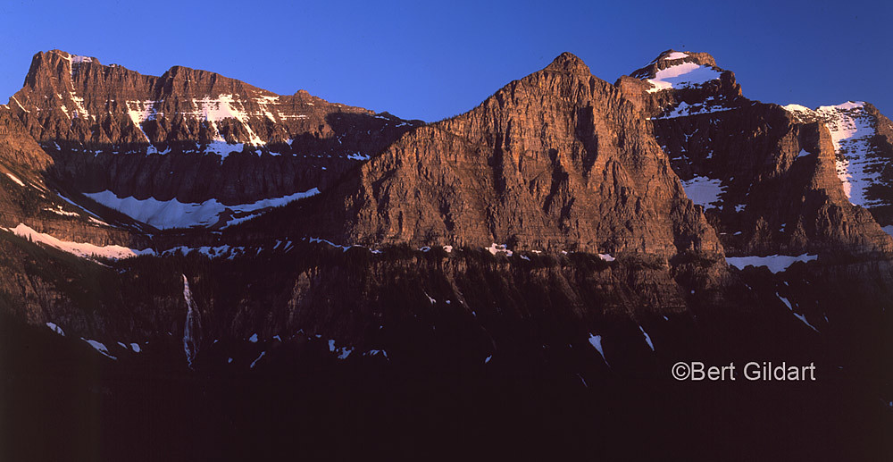
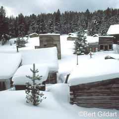
©Bert Gildart: In 1903 writer, editor, and naturalist George Bird Grinnell expressed his thoughts in Century Magazine about this land he had come to love, calling the area the “Crown of the Continent.” From the mountain goats who linger by the visitor’s center on Logan Pass to the crystal-clear glacier-fed lakes, from the magnificent views from the Many Glacier Hotel to the old-growth forest landscape, visitors will find much to ponder and enjoy within the pages of Glacier Icons: 50 Classic Views of the Crown of the Continent.
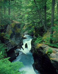
Bird Woman Falls, Glacier National Park
His image of and descriptive story about the magnificent glacier-carved landscape in the far reaches of Montana brought about the creation of Glacier National Park in 1910. Grinnell’s description is apt, but it is just one of the collective descriptions that evokes iconic images of Glacier, also called the “Land of Shining Mountains: and known by millions of visitors for their own personal stories and connections to its magnificent vistas and small wonders.
Glacier Icons: 50 Classic Views of the Crown of the Continent contains fifty essays in a book measuring 7×7. It contains 102 pages all filled with thousands of facts and almost 100 color photographs of iconic people, places, events, foods, animals, traditions, and more from all part of this great national park.
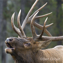
SAMPLE ICON:Hard, wind blown snow comes early to the park’s high peaks. It drives the elk down into the low country, it covers the boulder-strewn home of the mouse like pika, and it sends the powerful grizzly bear scurrying to its den for a long winter’s nap. In fact, the rugged alpine country forces just about every type of creature to leave or hide. But there always remains a beautiful little one-pound animal, a bird called the ptarmigan.
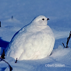
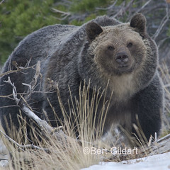
I met this strange bird while cross-country skiing with a ranger friend in Glacier National Park. At the time it was five below zero, and the wind was howling through the trees. Both of us were bundled in heavy down coats, warm leather mittens, and thick woolly long johns. Around us, the snowy world through which we plodded seemed a mighty deserted place. But suddenly, not more than a half dozen paces away, sat six balls of puffed-up feathers. They were pure white, as white as the snow over which we traveled, and it seemed strange that they had not taken wing. Confident in their ability to blend with the landscape, apparently fear was not part of their nature…
WHAT READERS ARE NOW STARTING TO SAY:
*We were privileged to get an advance copy of this book (because Emma is in one of the photos), and I have to say it’s really beautiful. Anyone who is a fan of Bert’s photography in Airstream Life will love this book. It certainly has inspired us to start thinking about a trip to Montana, to see the incredible beauty of Glacier again. In the meantime, Bert’s book is a wonderful peek “inside” this great national park. Rich Luhr, Editor, Airstream Life
*What a wonderful addition “Glacier Icons” is to the vast inventory of great books written about that world renowned park. The way you put it together makes for easy reading. I like it. Bob Haraden, Superintendent Glacier National Park 1980 to 1986
*As a book author I’m envious; as a photographer I’m downright jealous… Hundreds of facts not many of us know about Glacier National Park, what really is the best of the Last Best Places in Big Sky Country. Trust me folks…Ol’ Bert knows. And he knows how to show it and tell it big time…If you have any idea of ever visiting or just wanting to tour Glacier seat of pants style…YOU NEED THIS BOOK…over and out…Chuck
You can buy Glacier Icons: 50 Classic Views of the Crown of the Continent right here, from the authors. We’ll send it to you by USPS, and we’ll even autograph it for you with your choice of inscription. We use PayPal to allow us to take credit card orders. You don’t need to have a PayPal account, you can use any credit card, and the merchant (Bert and Janie) never sees your card number. And PayPal is very secure.
- 102 pages ~ 100 photographs ~ 50 iconic locations
- Get an autographed copy of Glacier Icons
- $16.95 plus $2.50 shipping


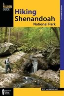 Hiking Shenandoah National Park is the 4th edition of a favorite guide book, created by Bert & Janie, a professional husband-wife journalism team. Lots of updates including more waterfall trails, updated descriptions of confusing trail junctions, and new color photographs. New text describes more of the park’s compelling natural history. Often the descriptions are personal as the Gildarts have hiked virtually every single park trail, sometimes repeatedly.