Donald Trump’s Wall
posted: January 28th, 2017 | by:Bert
©Bert Gildart: For the past few days Donald Trump has been discussing “The Wall,” and he’s finding it may not be as easy to separate the U.S. from Mexico with a huge, huge barrier as he had promised. Yes, some places may need a means of excluding Mexicans from entering the U.S. and that was certainly true in Arizona’s Organ Pipe National Monument. Here, parts of the terrain are ideally suited to stealth, and monitoring revealed that at the height close to 1,000 illegals were stealing across the 30-mile long border on a NIGHTLY basis. Many were drug runners, and some threatened visitors, and sometimes tragedies occurred. In 2002 Ranger Kris Eggle was killed by a drug runner.
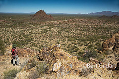
Dozens of “People trails” were being established and the trampling from thousands of footfalls quickly eroded the critical habitat required for the endangered desert antelope.


")
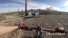
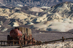
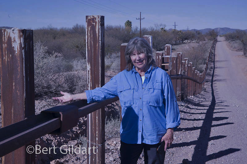
Here’s the way a five-mile section of road in Organ Pipe appears. Some of the fencing is obviously
cheap but one section, perhaps a mile long, was expensive and is used in other sections of the park.
As best I can determine, cost per mile is $2-3M.
When used in conjunction with other forms of detection, it has worked.
You can’t have this type of impact on a park designated as an International Heritage Park so here, in this specific part of the U.S., a wall was needed. Americans paid for it and the cost as best as I can determine for the high metal barrier section was $2-$3M PER MILE.


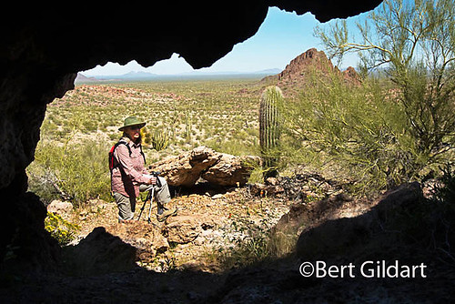
It is now safe again to hike remote sections of Organ Pipe, thanks in part to fencing.
It’s also made it safer for law enforcement rangers.
But the border fence didn’t completely solve the problem and to accomplish the goal of eliminating drug runners and, yes, sometimes undocumented aliens simply looking for work, officials had to do lots more, and here are a few of the extra measures that were required: They increased the border patrol from 50 to 500, installed huge monitors and night cameras, and periodically they make helicopter patrols. The combination has worked, and the park, which closed subsequent to the murder of Ranger Eggle, reopened two years ago. Now there are fences separating the border but some are more effective than others. The fences shown here separate a five mile segment of the U.S. from Mexico.

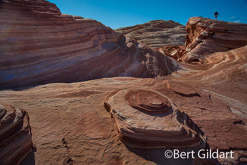
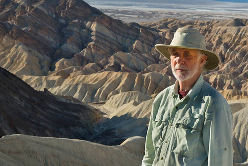
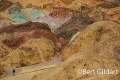
Building a wall worked in Organ Pipe and now the beauty of this incredible desert park
can be safely explored, here along the Ajo Mountain Loop Road.
Do we need a wall in other parts of the USA? Do Americans need the kind of protection Organ Pipe required?
Those are questions I can’t answer, but if we do, I doubt seriously if DT will be able to live up to his campaign promise. What I can say and want to emphasize is that if we do need a wall, it’s not because I agree with “OUR PRESIDENT’S” hyperbole that [Mexicans are] “bringing drugs. They’re bringing crime. They’re rapists…”
But to give the devil his due he concluded by saying “…some are good people.”
—————–
THIS TIME LAST YEAR:
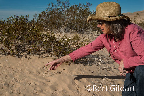
Mountain Biking in Anza Borrego
4th ed. Autographed by the Authors
Hiking Shenandoah National Park
 Hiking Shenandoah National Park is the 4th edition of a favorite guide book, created by Bert & Janie, a professional husband-wife journalism team. Lots of updates including more waterfall trails, updated descriptions of confusing trail junctions, and new color photographs. New text describes more of the park’s compelling natural history. Often the descriptions are personal as the Gildarts have hiked virtually every single park trail, sometimes repeatedly.
Big Sky Country is beautiful
Montana Icons: 50 Classic Symbols of the Treasure State
![]() Montana Icons is a book for lovers of the western vista. Features photographs of fifty famous landmarks from what many call the “Last Best Place.” The book will make you feel homesick for Montana even if you already live here. Bert Gildart’s varied careers in Montana (Bus driver on an Indian reservation, a teacher, backcountry ranger, as well as a newspaper reporter, and photographer) have given him a special view of Montana, which he shares in this book. Share the view; click here.
Montana Icons is a book for lovers of the western vista. Features photographs of fifty famous landmarks from what many call the “Last Best Place.” The book will make you feel homesick for Montana even if you already live here. Bert Gildart’s varied careers in Montana (Bus driver on an Indian reservation, a teacher, backcountry ranger, as well as a newspaper reporter, and photographer) have given him a special view of Montana, which he shares in this book. Share the view; click here.
$16.95 + Autographed Copy
What makes Glacier, Glacier?
Glacier Icons: 50 Classic Views of the Crown of the Continent
![]() Glacier Icons: What makes Glacier Park so special? In this book you can discover the story behind fifty of this park’s most amazing features. With this entertaining collection of photos, anecdotes and little known facts, Bert Gildart will be your backcountry guide. A former Glacier backcountry ranger turned writer/photographer, his hundreds of stories and images have appeared in literally dozens of periodicals including Time/Life, Smithsonian, and Field & Stream. Take a look at Glacier Icons
Glacier Icons: What makes Glacier Park so special? In this book you can discover the story behind fifty of this park’s most amazing features. With this entertaining collection of photos, anecdotes and little known facts, Bert Gildart will be your backcountry guide. A former Glacier backcountry ranger turned writer/photographer, his hundreds of stories and images have appeared in literally dozens of periodicals including Time/Life, Smithsonian, and Field & Stream. Take a look at Glacier Icons
$16.95 + Autographed Copy


")


")
")
")
")


")
")
")
")
")
")
")
")
")
")
")
")
")
")
")


