Facebook Crossovers
©Bert Gildart: Because of the social nature of FACEBOOK, I generate many more quick responses and “Likes” using that form of social media then I do by posting blogs.
As a result, I sometimes overlook the people who say, “Sorry, we want to know what you’re doing, but we don’t want to deal with another program. As an attempt to share I’m going to start summarizing some of my Facebook postings on my blog. By so doing, I hope to make my blog postings more than just a hit or miss project.
As a result you’ll see two postings here, one on biking, the other about photography and magazine submissions.
———
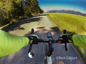
YESTERDAY I BIKED 26.4 MILES along a series of secondary roads that departed from our drive. Locals will recognize the route as consisting of Riverside Road, Fishhatchery Road, Foothills Road and finally, LaBrant. For the most part it is an agrarian setting and signs along the way told of the price of a dozen fresh farm eggs ($2.75); of dirt roads to Jewel Basin Hiking area; and, naturally — in this area — of how best to prepare for life in the hereafter.
As I ride I monitor activities with a top-of-the-line Garmin, which was a birthday gift from my lovely wife. Information is thorough and includes standard data such as rate of travel, average speed and both heart and cadence rate. When home all this information can be downloaded onto my cell phone or onto my computer. I can also examine my route in the form of a map.
For any interesting in the map, and the information just mentioned, here’s a link. Generally I find it takes about 20 seconds for the data to load.
I find the program helpful as I chart attempts to improve overall conditioning — and later, to look back on a very interesting bike adventure.
https://connect.garmin.com/modern/activity/1271194635
—————————–
AND NOW MY ENTRY ON THE SUBMISSION OF IMAGES FOR AIRSTREAM LIFE: Just completed a story for Airstream Life magazine, a periodical that appeals to a travel-oriented audience. Most readers are highly adventurous and many are interested in nature photography. Obviously most tow an Airstream.
The magazine is “slick” meaning my images are reproduced with great fidelity
The magazine started about 12 years ago and I’ve sold to every issue since its inception. Images accompany my stories and are sometimes related to the season, in this case to fall travel here in the West. Over the years I’ve covered areas from all of the Canadian provinces and from areas embraced by all four corners of the U.S. Generally our trips are also made for other magazines as well.
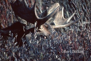
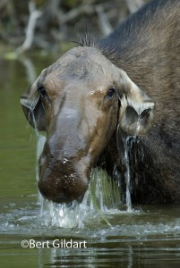
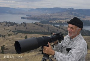
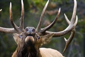
Note the belligerence in the eye of the moose, now in rut and potentially a very dangerous and aggressive animal. Not so the cow moose, simply interested in plucking vegetation from the bottom of this pond. Photo by Bill Mullins, one of the nation’s top nature photographers.
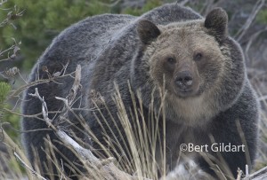
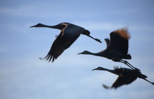
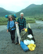
To facilitate layout I try and give editors at the magazine a wide selection – far more than what they’ll use. In this case I’m sending about 40 images, realizing the final cut will total about 10. Here are a few samples from which they’ll be selecting. Certainly, I have no objection if they select the one Bill Mullins took of me out on Montana’s Wildhorse Islands.
Mullins is a top photographer and a good friend. He’s from Idaho and I was delighted to have seen him several weeks ago at the annual convention of the Outdoor Writer Association of America, which this year was held in Billings, Montana.
————————————-
THIS TIME LAST YEAR:
4th ed. Autographed by the Authors
Hiking Shenandoah National Park
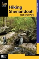 Hiking Shenandoah National Park is the 4th edition of a favorite guide book, created by Bert & Janie, a professional husband-wife journalism team. Lots of updates including more waterfall trails, updated descriptions of confusing trail junctions, and new color photographs. New text describes more of the park’s compelling natural history. Often the descriptions are personal as the Gildarts have hiked virtually every single park trail, sometimes repeatedly.
Big Sky Country is beautiful
Montana Icons: 50 Classic Symbols of the Treasure State
![]() Montana Icons is a book for lovers of the western vista. Features photographs of fifty famous landmarks from what many call the “Last Best Place.” The book will make you feel homesick for Montana even if you already live here. Bert Gildart’s varied careers in Montana (Bus driver on an Indian reservation, a teacher, backcountry ranger, as well as a newspaper reporter, and photographer) have given him a special view of Montana, which he shares in this book. Share the view; click here.
Montana Icons is a book for lovers of the western vista. Features photographs of fifty famous landmarks from what many call the “Last Best Place.” The book will make you feel homesick for Montana even if you already live here. Bert Gildart’s varied careers in Montana (Bus driver on an Indian reservation, a teacher, backcountry ranger, as well as a newspaper reporter, and photographer) have given him a special view of Montana, which he shares in this book. Share the view; click here.
$16.95 + Autographed Copy
What makes Glacier, Glacier?
Glacier Icons: 50 Classic Views of the Crown of the Continent
![]() Glacier Icons: What makes Glacier Park so special? In this book you can discover the story behind fifty of this park’s most amazing features. With this entertaining collection of photos, anecdotes and little known facts, Bert Gildart will be your backcountry guide. A former Glacier backcountry ranger turned writer/photographer, his hundreds of stories and images have appeared in literally dozens of periodicals including Time/Life, Smithsonian, and Field & Stream. Take a look at Glacier Icons
Glacier Icons: What makes Glacier Park so special? In this book you can discover the story behind fifty of this park’s most amazing features. With this entertaining collection of photos, anecdotes and little known facts, Bert Gildart will be your backcountry guide. A former Glacier backcountry ranger turned writer/photographer, his hundreds of stories and images have appeared in literally dozens of periodicals including Time/Life, Smithsonian, and Field & Stream. Take a look at Glacier Icons
$16.95 + Autographed Copy
