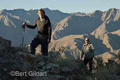
Summitting (Almost) Coyote Peak
©Bert Gildart: Coyote Peak, in Anza Borrego Desert State Park, though not a formidable mountain, is challenging nevertheless, and several days ago, four of us attempted a summit. The group was a good one, and we almost made it, but Jim pulled a muscle in his leg and felt he had to return. It can happen to anyone and it was smart to call it quits rather than find at some yet more distant point that it would then be extremely difficult to make it back. The rule, of course, is that the party stays together, and in the past, I’ve been the beneficiary, so no complaints from me.
Summit of Coyote Peak, our goal
Nevertheless, Don, Nancy and I were disappointed, but still, we can say that we were almost to the top, and we will try again! What we did see of the landscape as we climbed only whetted our desire to see more of the world from the very tipi-top of Coyote.
WHY CLIMB COYOTE
Coyote Mountain separates lower Coyote Canyon and Clark Valley, and it rises 3,192 feet above sea level. That may not seem like a lot but the elevation here at Peg Leg is about 500 feet, meaning the relief was about 2,700. When we turned around we’d climbed within several hundred feet of the top and could see a whole range of peaks.
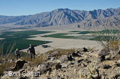
Using our topo map we could find the Santa Rosa and San Ysidro Mountain range as well as specific peaks such as Indianhead and El Toro. We could see the vast citrus farmlands to the west and the Borrego Badlands to the southeast. We could also see Coyote Canyon and could trace the route made famous by de Anza, when he first explored the area back in 1775.
YET OTHER ROUTES
Though there are various ways one can climb Coyote Peak we decided to make the short drive from Peg Leg to the trailhead for Alcoholic Pass. (Other routes start from Peg Leg and from near the Rockhouse Canyon road.)
From our map the Alcoholic Pass route seemed the most direct. What’s more, it seemed to offer a particularly interesting route.
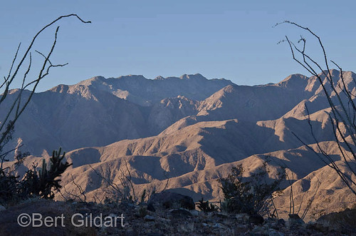
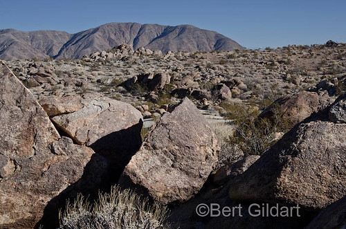
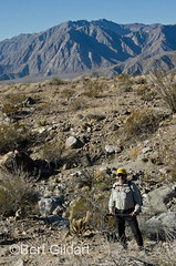
Mountains engulf us throughout our climb
As we climbed boulder fields stretched before us and the geology seemed fascinating. We concluded the landscape was the result of the encroachment of both ancient seas and from more recent volcanic activity. Sheep tracks and dropping were everywhere, and Nancy found an old sheep horn.
WE’LL START FROM PEG LEG
The route was a good one, and though we now know the route, Don, Nancy and I believe we will simply start from Peg Leg next time we attempt to climb Coyote. It’s really not a difficult peak to climb (Rainier was!) and it was simply bad luck that foiled us.
We hope to climb the peak in about a week or so. Though not the highest mountain around, it offers wonderful views and interesting features. Some also report the presence of a sheep herd near the top of the mountain, and we hope to find them as well.
More later…
——————————-
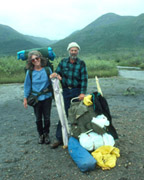
AIRSTREAM TRAVELS TWO (ABOUT) YEARS AGO: